Project Outline: Geospatial Mapping of ECMO referrals
When a patient’s lungs or heart fail despite the best available treatments, doctors sometimes turn to one of the most advanced forms of life support available: Extracorporeal Membrane Oxygenation (ECMO). This technique oxygenates and circulates blood outside the body, giving patients with conditions such as severe respiratory failure, cardiac arrest, or complex congenital heart disease a critical chance of survival.
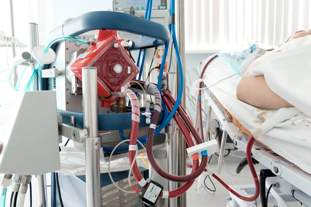
As I write this I am at the Royal Brompton Hospital, one of the UK’s leading ECMO centres. But ECMO is not available everywhere. In the UK, it is provided in a small number of highly specialised centres, meaning that hospitals must refer patients to these hubs for consideration. I hypothesise that the question of whether a patient can access ECMO depends not only on their clinical condition, but also on geography, networks of communication, and the ability to transfer them safely in time.
From Graphs to Maps: Understanding Referrals
As part of my Laidlaw Scholarship, I set out to explore how referrals to ECMO centres are distributed across hospitals in the UK, and what this might reveal about patterns of demand, clinical decision-making, and potential inequalities.
Using Maps to Ask New Questions
My current project explores how geospatial mapping techniques can help us understand these patterns of access. By combining information on referrals, outcomes, and hospital networks with mapping and data visualisation tools, I will be creating visual representations of how ECMO services are used across the UK.
The aim is not just to analyse numbers, but to reveal flows, clusters, and disparities that might otherwise remain hidden. Whether through heatmaps, flow maps, or time-based trends, the power of spatial analysis lies in its ability to show the bigger picture in a way that is both intuitive and impactful.
The Road Ahead
Over the coming weeks, I will be refining these methods and preparing outputs that highlight the potential of geospatial approaches in healthcare service evaluation. The work is still at an early stage, but it has the potential to spark valuable conversations about how we deliver highly specialised, resource-intensive care in a fair and effective way.
The Goal
As this project develops, I hope to demonstrate how mapping is not just about geography — it is about making systems visible, asking new questions, and opening up opportunities to design services that give patients the best possible chance, wherever they are.
Hi! I’m Zach — a fifth-year medical student at Imperial College London, and an Honorary Clinical Research Fellow at the Royal Brompton Hospital, one of the world’s leading cardiothoracic centres. My work sits at the intersection of critical care medicine, health-services evaluation, and data-driven translational science.
Through my Laidlaw project, EQUALISE, I built geospatial and temporal analyses of national ECMO referrals to investigate equity of access to extracorporeal life support across the UK — working alongside clinicians, NHS England commissioners, and regional networks to turn data into evidence that shapes service planning. The analytical pipelines were subsequently adopted by the National ECLS Service Evaluation.
For my Leadership-in-Action project, I’m working as a Clinical & Scientific Fellow with the Africa Clinical Research Network (ACRN), helping design a federated, African-led real-world evidence platform.
Back in the lab, my current research investigates gas-phase metabolomic signatures during cardiopulmonary bypass, working toward novel non-invasive diagnostics.
Outside research, you’ll find me at bachata and salsa socials across London!
Please sign in
If you are a registered user on Laidlaw Scholars Network, please sign in