Measurement vs. Meaning
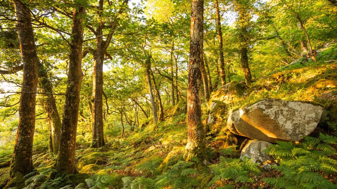
The broader idea behind Nature’s Pharmacy Project came from my interest in the ecological importance of forest soils. Forest ecosystems are heavily supported by soil microbe communities, as they aid in decomposition, nutrient cycling, and other fundamental processes. Unfortunately, these communities are difficult and expensive to characterize directly. Because of these prohibiting factors, a land steward or private landowner would be unlikely to sequence soil microbial communities as a routine part of forest management.
By contrast, visible forest structures can be measured with relative ease. A practitioner can count the number of woody species in a plot, measure fallen deadwood, or record the leaf litter depth on the forest floor, all with inexpensive equipment. My initial goal with this project was to look into whether simple habitat measurements like these could be turned into an interpretable field assessment. However, the difference in the amount of work between taking a measurement and being able to say what that measurement means was bigger than I had anticipated at the beginning of my journey. Consequently, most of my work has been spent building the bridge between collection and interpretation.
The first major step in building this bridge was literature discovery. I started my search broadly, looking for any studies connecting visible forest habitat features to soil microbial properties in temperate forests. I looked at many features including plant diversity, coarse woody debris, litter, canopy cover, and disturbance history. I also looked at microbial outcomes such as biomass, fungal properties, enzyme activity, and community composition.
The next stage of my research was primary-source verification. For the studies that seemed to be most relevant to what I was attempting to do with my project, I went back to the published papers and checked what the researchers had measured, at what scale, and with what result. This became one of the most important parts of the process, as simply looking at the titles and abstracts makes two papers seem much more related than they really are.
For example, one paper showed that the soil directly underneath a fallen log differs from soil a meter away. Although it may be useful evidence that deadwood affects its local environment, it's not the same as showing that the total deadwood volume across the entire forest predicts soil conditions at the plot level. Similarly, a study I read experimentally manipulated litter inputs which came to some interesting results, but it is not measuring the exact same thing as a practitioner placing a ruler into the standing litter layer of their forest plot.
These different distinctions began changing how I read through the papers. I spent more time in the methods section asking a multitude of questions. What counted as deadwood? Where did the litter measurement stop? What minimum stem size qualified a plant species for inclusion? How large was the plot? Was the study measuring the same variable I planned to measure, or only something related to it?
Concurrently with the literature review, I began to develop the field protocol itself. My aim was to keep the assessment simple and practical enough that it could be carried out without specialized equipment, while still making the measurements reproducible and comparable with other existing ecological datasets.
In order to complete these goals, I had to make very specific decisions. For coarse woody debris, for example, the minimum piece diameter, transect length, and calculation method all matter. For leaf litter, the observer needs a clear definition of whether they are measuring recognizable surface material or the entire organic layer. This work led me to another major part of this project: Finding external datasets that could provide reference values.
Raw data from the field is not very useful if there is no basis for judging it. If I measure 12 cubic meters of fallen deadwood per hectare, I know how much deadwood I encountered but not if that is unusually little, typical, or unusually abundant. Rather than inventing those categories, I wanted them to come from real forest data. For coarse woody debris and surface litter, I worked with the USDA Forest Service Forest Inventory and Analysis program (FIA). The data from this inventory allowed me to identify a reference population of hardwood and mixed-forest plots across Vermont, New Hampshire, Massachusetts, Connecticut, and Rhode Island. This data made it possible for me to calculate empirical distributions for the measurements instead of solely relying on arbitrary cutoffs.
My third variable, native woody richness, required a different source because the scale of the reference data needed to match the 20-by-20 meter field plots. The Harvard Forest ForestGEO census provided that matched scale through hundreds of 400 m² quadrants. I then proceeded to examine how the distribution of richness behaved under different definitions, and whether unusual parts of the census area changed the resulting range boundaries.
One interesting thing I learned from this stage is that simply finding a large dataset is not enough. The field protocol and reference data must measure the same thing in similar-enough ways. A reference value derived from one definition cannot automatically be applied to a field value produced under another. This problem of comparability quickly became one of the central themes of my project.
At this point, I now have a much clearer framework than I had at the start of the summer. I have created three field measurements with explicit definitions, external datasets that provide empirical reference distributions, practitioner-oriented measurement protocols, and a developing system for translating raw values into statements about where a plot ranks relative to its reference population
This makes the practical goal of my project straightforward. Instead of giving a land steward a number such as “12 m³/ha of fallen deadwood,” the framework I built should make it possible to say:
My plots average 12 m³/ha of fallen deadwood, placing this stand in the lower quarter of the central and southern New England reference distribution for deadwood volume.
This is exactly the kind of result I want my project to deliver, not just measurements, but interpretations. The literature review also has begun to change my overall understanding of what my final product can legitimately claim. At the start of this project, I was mainly thinking about how visible habitat features could serve as indicators of below-ground ecological recovery. Now, the evidence has made me much more careful about separating the ecological importance of a feature from what a simple field measurement can really demonstrate. Up until this point, my work has been less about finding a single “right” number than I thought. It has been about building the basis of what makes a number trustworthy, namely finding the evidence, checking the original studies, defining the field measurement precisely, locating an appropriate reference dataset, and making sure the two are actually comparable. Only then does a number begin to mean something.

Hello! My name is Harry, and I am a student at Tufts University and part of the 2026 cohort of Laidlaw Scholars.
My research project investigates whether simple, low-cost habitat measurements can predict soil microbial diversity in recovering New England forests. Using five field-measurable variables, I am developing the Habitat-Based Microbial Recovery Index (hMRI): a "health score" for forest soils that conservation organizations and land managers can use without expensive lab sequencing.
Through this research, my overall goal is to reframe rewilding as a public health strategy, not just an environmental one. As antibiotic resistance is increasing, some of the most promising sources of new antibiotics are soil microbes. By identifying which recovering forests have conditions associated with strong microbial communities, I hope to help direct conservation efforts toward the forests most likely to yield tomorrow's medical discoveries.
If you would like to connect or have any questions at all, please feel free to reach out!

Please sign in
If you are a registered user on Laidlaw Scholars Network, please sign in