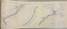
The Delaware Water Gap–a forty-mile stretch of New Jersey and Pennsylvania land along the Middle Delaware River– was acquired by the federal government in the 1960s for the Tocks Island Dam project. Though officially deauthorized in 2002, the unbuilt dam project displaced 15,000 residents and left a legacy of visceral governmental distaste resulting from eminent domain. While existing research examines eminent domain’s social disruption to local communities, it rarely connects these impacts with environmental patterns and ongoing environmental concerns. The Army Corps of Engineers hoped to dam the Middle Delaware River, due to flood concerns, drinking water needs, and recreational purposes. Combining firsthand accounts, historical records and original interviews with former residents, this research illustrates a narrative of environmental impact, governmental overreach, and community resilience despite a cycle of disruption. In the 40 years between when the Tocks Island Dam Project was authorized and subsequently deauthorized, the government and residents held contesting perspectives of what constitutes the ‘environment’ and what is deemed grounds for environmental intervention. Residents included man-made components in the environment they hoped to protect and sustain, while the federal government seemed to focus more on the natural environment as something to control and reshape, which fed a recurring fear of unwanted governmental authority, as dam project proposals continued to resurface as ‘flood control’ and ‘recreation management.’ To this day, the land is a National Recreation Area owned by the National Park Service and residents continue to fight against new governmental proposals and environmental concerns of droughts, floods, and worsening climate patterns.

Hello! I'm Kate Morton, a rising Junior at Barnard College from Baltimore, Maryland, USA, pursuing a combined major in Environment & Sustainability and Human Rights with a minor in Dance. My Laidlaw Research combines land rights, history, ecology, and environmental justice to explore how eminent domain reshaped socio-ecological conditions in the Delaware Water Gap National Recreation Area along the Delaware River between Pennsylvania and New Jersey.